The City of Hilliard is investing in transformative improvements along Leap Road that will enhance safety, accessibility, and the overall look and feel of this important corridor.
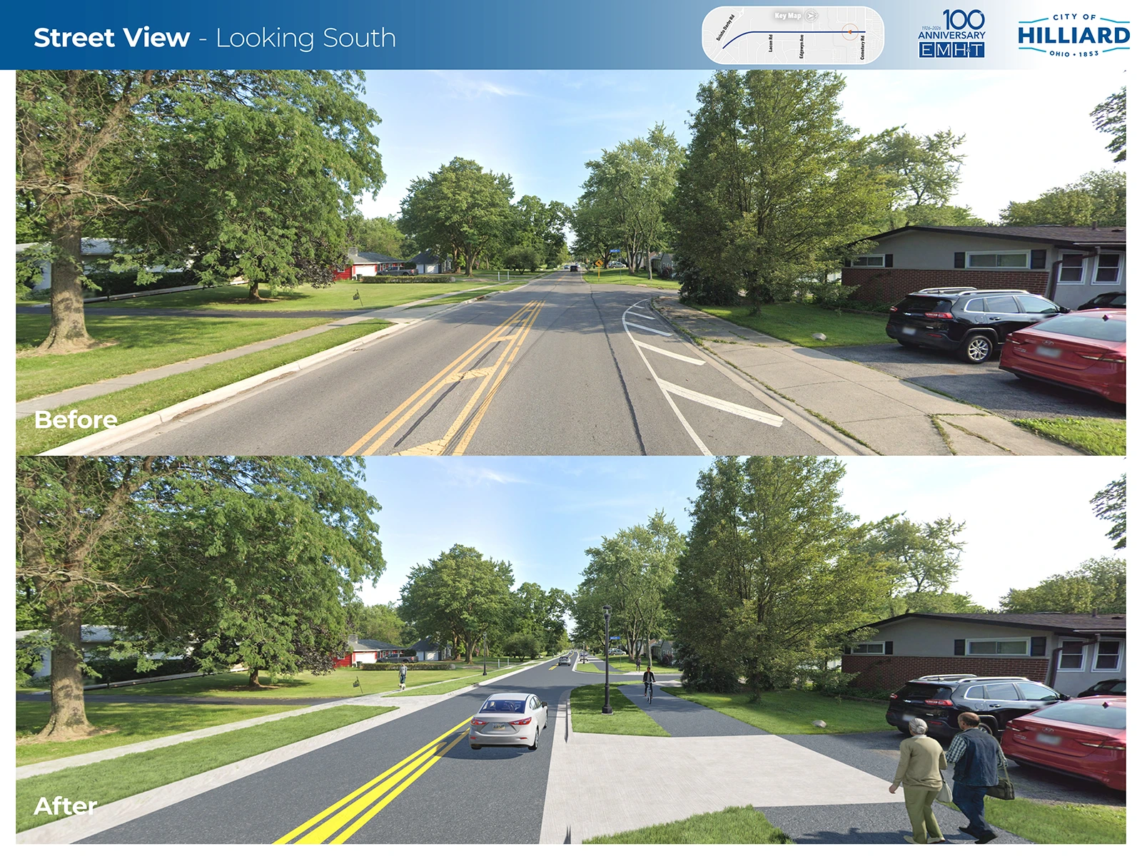
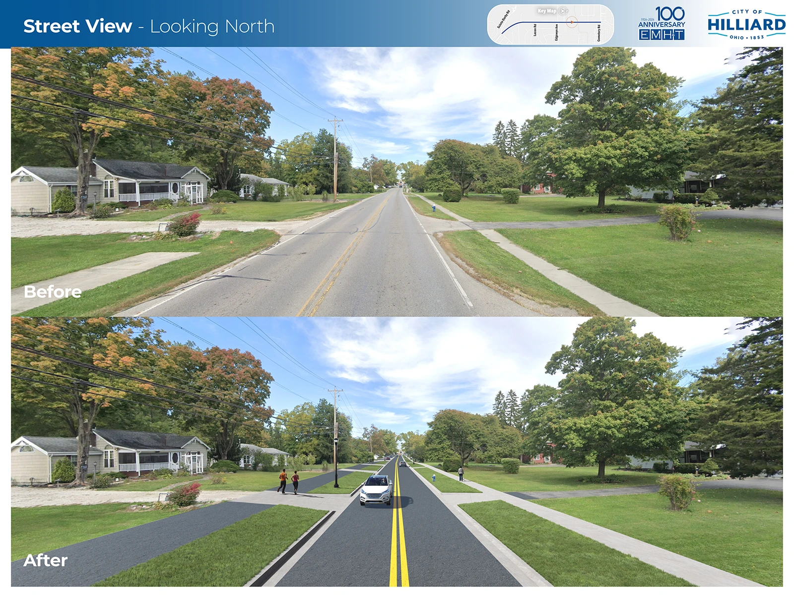
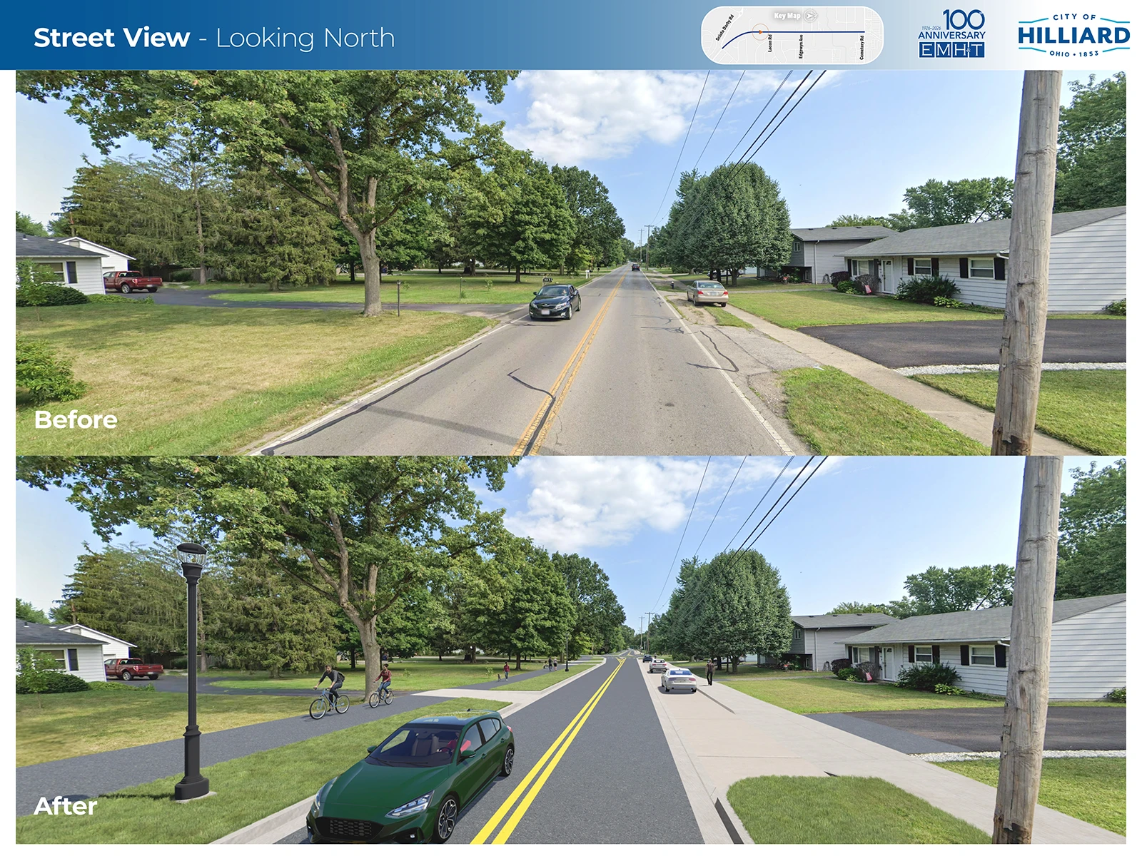
This project will reimagine Leap Road (from Cemetery Road to Scioto Darby Road) as a more inviting, walkable, and bike-friendly street while also addressing long-standing drainage challenges that impact the area during heavy rain events.
Today, several sections of the corridor, including sidewalks along the east side, can experience standing water or muddy conditions after storms. Much of the existing infrastructure is more than 50 years old, and the underground utilities beneath the roadway are even older.
Through this major investment, the City will fully reconstruct Leap Road, replacing aging utilities and upgrading drainage systems to better manage stormwater and reduce ponding. In addition, the project will elevate the street’s character from a county roadway to a City-managed corridor designed with the community in mind to create a cleaner, safer, and more attractive public space for residents, visitors, pedestrians, and cyclists alike.
We invite residents to provide feedback and input on this project using the survey below. The deadline to submit the survey is April 30.
Today, Leap Road experiences challenges like:
These issues make it difficult for people to walk, bike, and move safely through the corridor. They also contribute to neighborhood drainage problems. Rebuilding Leap Road gives us the chance to fix the root causes, not just apply short-term patches.
The City is also considering options to lower the speed limit along the corridor
Work will occur in phases over multiple seasons. Some temporary street closures will be needed, and detours will be communicated early. Local access to driveways will be maintained throughout the project, except for short closures during driveway reconstructions. Construction updates will be shared with residents periodically.
The City will work to minimize impacts and maintain access to all private property. To build sidewalks, paths, and drainage improvements, the City may need small strips of right-of-way or temporary construction easements from some properties along the corridor.
The precise type and limits of easements will not be determined until 2027. Owners of affected properties will be contacted individually at that time.
Residents can help identify the presence of lead services (see survey). Otherwise, the City will need to enter your basement to inspect your water service material.
The overall project cost is estimated to be between $9.5 – $10.5 million.
The City has secured $6.7 million in funding from the voter supported LinkUS Transit Supportive Infrastructure (TSI) Capital Improvement Program. The City intends to seek additional outside funding through the Ohio Public Works Commission (OPWC). The balance of project cost will be covered by City funds.
Actual dates depend on funding and final design.
2022 – Project initiated under safety and mobility program
2023 – Conceptual alternatives study completed for Leap Road south of Cemetery Road
2024 – Cemetery Road/Leap Road Safety Study completed; Leap Road south identified as a key corridor for Transit Supportive Infrastructure and awarded funding through MORPC
2025 – Surveying and preliminary engineering
2026 – Public engagement, detailed design
2027 – Acquisition of right-of-way and easements
2028 – Relocation of private utilities (electric, gas, telecommunications)
2029 – Construction anticipated
We are asking for resident input and feedback on this project.
Further questions can be directed to Transportation Project Manager Nick Vandia.


Hilliard is happening! Find out what’s going on with our weekly newsletter.